Navigation
Sylvia Earle Alliance’s Mission Blue and Partners Establish Ocean Hope Spots
- Agencies
- Aichi
- America's Cup Healthy Ocean Project
- Arctic
- biodiversity
- Callum Roberts
- Caribbean
- Carl Gustaf Lundin
- climate
- Dr. Sylvia Earle
- ecosystems
- Editorial
- Films
- Global Partnership for Oceans
- High Seas
- IMPAC 3
- Invasive Alien Species
- IUCN
- marine protected areas
- Marseille
- Mediterranean
- National Geographic
- Oceankind
- oceans
- Pacific
- Program UNEP
- Protect Planet Ocean
- Sylvia Earle Alliance
- TED
- UNESCO
- Biodiversity
- Endangered Species
- Oceans, Coral Reefs
- Pollution
On October 22, 2013, news coming from the 3rd International Marine Protected Areas Congress (IMPAC 3) reported that Dr. Sylvia Earle, Mission Blue and the International Union for Conservation of Nature (IUCN), have launched 31 new Mission Blue Hope Spots -- places of special significance in the ocean where Mission Blue will focus its efforts. There are now 50 Hope Spots globally. Mission Blue calls this “a path forward for protecting our Blue Heart.”
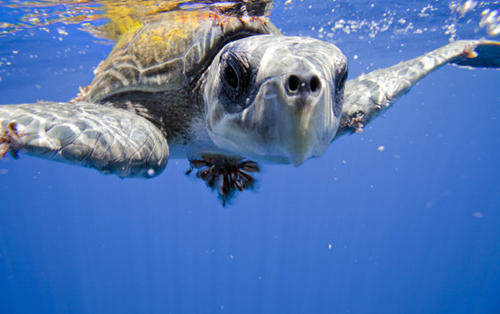 The Eastern Pacific Seascape spans Central and South America, covering a total of 2 million square kilometers.: Photograph© Kip Evans / Mission Blue (Cocos)
In his Prologue to his book “Ocean of Life: The Fate of Man and the Sea,” Callum Roberts writes:
“The last two hundred years have seen marine habitats wiped out or transformed beyond recognition. And with an ever accelerating tide of human impact, the oceans have changed more in the last thirty years than in all of human history before. In most places the oceans have lost upward of 75 percent of their megafauna -- large animals such as whales, dolphins, sharks, rays, and turtles – as fishing and hunting spread in waves across the face of the planet. For some species numbers are down as much as 99 percent as is the case for oceanic whitetip sharks of the high seas, American sawfishes, and the ‘common’ skate of Northern Europe. By the end of the twentieth century, almost nowhere shallower than three thousand feet remained untouched by commercial fishing and some places are now fished to ten thousand feet down.”
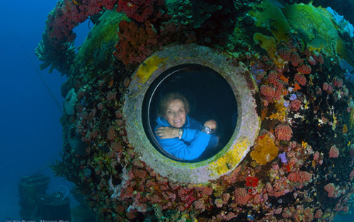 Dr. Sylvia Earle, "Her Deepness” peering out from a porthole.: Feature Photograph by Kip Evans / Mission Blue
“We can change. We can turn around our impacts on the biosphere. We can live alongside wild nature. The alternative is self-destruction,” Callum concludes, then offering a list of organizations he has worked with and recommends for their “dedication, innovation, and effectiveness.” Among them is the Sylvia Earle Alliance.
Roberts calls Dr. Sylvia A. Earle, founder of the Alliance, “the most eminent advocate for ocean conservation in the world.”
Sylvia Earle used the chance given to her to “Make Her Wish” when she won the TED Prize in 2009, to call upon everyone “to use all means at your disposal — films, expeditions, the web, new submarines — to create a campaign to ignite public support for a global network of marine protected areas; Hope Spots large enough to save and restore the blue heart of the planet.” Her talk, seen below in the video, has now been viewed by more then 537,000 people she may have inspired to help.
Sylvia Earle's TED Prize Talk
In response to her wish, Mission Blue was formed as an initiative of the Sylvia Earle Alliance. Mission Blue began creating a coalition of partners to work together to improve the health of the ocean, as the organization calls it, an ocean community hub “that seeks to make good on Sylvia’s wish by elevating public awareness about critical ocean issues and inspiring support for organizations, projects and scientific expeditions that make a positive difference for the ocean. From large multinationals to barebones scientific teams, partners are each doing their part to raise awareness about the beauty -- and fragility -- of the blue heart of our planet. Together our goal is to create a global network of Marine Protected Areas, flourishing ocean environments that will form the seed of tomorrow's healthy ocean.”
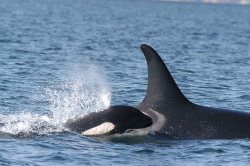 Keeping Up: Southern Resident Killer Whale mother and her calf swimming.: Photograph courtesy of National Oceanic and Atmospheric Administration National Ocean Service
MPAs are akin to parks on the land, places where human activities are limited by local or national laws or traditions. IUCN defines MPAs as “A clearly defined geographical space, recognised, dedicated and managed, through legal or other effective means, to achieve the long-term conservation of nature with associated ecosystem services and cultural values.”
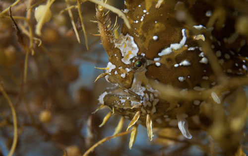 Our photo of the week of September 05, 2013, was the Sargassum Fish, Histrio histrio, to celebrate Mission Blue’s: Sargasso Sea Hope Spot and the work of the Sargasso Sea Alliance. An iconic resident of the Sargasso Sea, its life is typically spent adrift on tropical and warm temperate oceans among floating Sargassum Weed. Although the Sargassum Fish is capable of swimming quite rapidly, it often crawls through the Sargassum Weed, using its pectoral fins like arms. The unique appearance of the fish features stalked, grasping, limb-like pectoral fins with small gill openings behind the base, a trapdoor-like mouth high on the head, and a “fishing lure” on the snout. The Sargasso Fish is an ambush predator and also a cannibal – one individual was found to have 16 juveniles in its stomach! It hunts by dangling its ‘fishing lure’ to attract small fish, shrimps and other invertebrates. It is able to dart forward to grab its prey by expelling water forcibly through its gill openings. It can expand its mouth to many times its original size in a fraction of a second, drawing prey in via suction, and can swallow prey larger than itself. To avoid underwater threats it can leap above the surface onto mats of weed, and can survive for some time out of water. Feature Photograph by Justin Lewis, 70 Degrees West courtesy of Mission Blue Mission Blue congratulates The Sargasso Sea Alliance on their 2013 SeaKeeper Award at the Bal de La Mer!
Protected areas, Roberts writes in “The Ocean of Life,” “do things that fishery managers cannot achieve without them…” Reserves can boost the resilience of fish populations, he states, and they can “bring back habitats swept away by trawls or dredges, and reverse habitat collapses induced by plagues of grazers like sea urchins let loose by the removal of their predators.
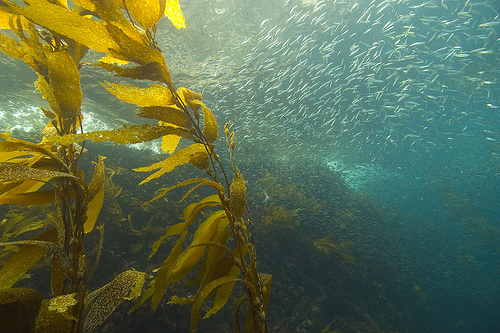 Kelp and sardines, Anacapa Island, Channel Islands National Marine Sanctuary.: Text and Photograph courtesy of NOAA's National Ocean Service
"If you could fast-forward through years after a reserve was created, you would see kelp forests rise from the seabed, sea grasses thicken and spread, sediments disappear under crusts of invertebrates, like oysters and sponges, that elbow their way above the bottom. The gradual rebuilding of these underwater metropolises increases the capacity of the sea to sustain life. There are more ways to make a living and more places to hide.”
Ocean Overview
Oceans generate 70% of the oxygen in the air, and absorb much of its carbon dioxide. They drive the climate, the weather and the chemistry of the planet. Our oceans occupy over 2/3 of the planet’s surface and provide a home for most of the creatures on Earth. Unfortunately, our knowledge of the ocean is less than our impact on it. It isn't too late to expand on our understanding of the world’s oceans, and to use that knowledge to effect positive change. National Geographic: Oceans
Credits: National Geographic Sylvia A. Earle
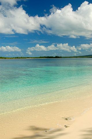 Eratap Beach, Vanuatu, 23 July 2011: Photograph by Niki Gango courtesy of WikipediaAn example a successful type of management of marine protected areas was described by Robert E. Johannes , in Vanuatu “where a government fisheries department provides scientific information and advice (as well as certain basic conservation laws), while coastal villages assume the bulk of the responsibility for local management — is a form of what is sometimes referred to as cooperative management...The Fisheries Department set this trend in motion by assisting villages with their trochus [a sea snail] management. The efforts of the Department and the benefits of closures are now widely appreciated by villagers, who have extended such controls to other species.”
“Networks of marine protected areas maintain healthy biodiversity, provide a carbon sink, generate life-giving oxygen, preserve critical habitat and allow low-impact activities like ecotourism to thrive,” says Mission Blue. “They are good for the ocean, which means they are good for us. We are often asked, ‘How much protection is enough?’ We can only answer with another question: How much of your heart is worth protecting?”
Sylvia Earle's Mission to Protect the Oceans
Uploaded on YouTube June 3, 2013.
On October 22, 2013, news coming from the 3rd International Marine Protected Areas Congress (IMPAC 3) reported that Dr. Sylvia Earle, Mission Blue and the International Union for Conservation of Nature (IUCN), have launched 31 new Mission Blue Hope Spots -- places of special significance in the ocean where Mission Blue will focus its efforts. There are now 50 Hope Spots globally. Mission Blue calls this “a path forward for protecting our Blue Heart.”
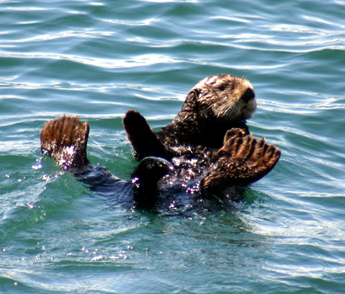 A Sea Otter: Sea otters are a “keystone species” within the kelp forest community, as they control: the red sea urchin population, effectively keeping the entire ecosystem in balance. Text and Photograph courtesy of NOAA's National Ocean Service
“Hope Spots are special places that are critical to the health of the ocean — Earth’s blue heart,” says Mission Blue. “Some of these Hope Spots are already formally protected, while others still need defined protection.”
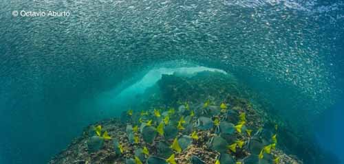
“The ocean as a system, our life-support system, is in trouble and whatever we can do, whether it’s in our community, state or country, region, or in the high seas, we should really respect what the ocean gives us,” says Sylvia Earle. “Not what we can take out of the ocean in terms of pounds of fish, minerals, oil or gas or the fact that we can use the ocean as a dumpsite. What we extract from the ocean that’s most meaningful is our existence. Our job should be to return this favor and keep the ocean alive.”
"Hope Spots are a wonderful network of places around the world which are new to many of us," says Carl Gustaf Lundin, Director, IUCN Global Marine and Polar Programme. "These are areas that in many ways represent all the amazing things we have in the ocean. This is a great opportunity to really cherish these areas and make sure we take care of them for the next generation.”
A map and description of hope spots, new, existing, and proposed, is available at http://mission-blue.org/hope-spots-new/.
Mission Blue and IUCN are sending a “message of hope,” as they call for mobilization of the international community to take action, “needed to reverse the ocean’s current state of peril while we are still able to change course….”
Among the current “Hope Spots” are The Eastern Pacific Seascape, Bering Sea Deep Canyons, and the Coral Sea described briefly on the Mission Blue website:
Bering Sea Deep Canyons
“Home to ocean albatross and kittiwakes, orcas, walrus and fur seals, king crab, squid, salmon and cold water corals, the Bering Sea Canyons Hope Spot supports a near endless variety of life. But the Bering Sea’s beautiful and carefully-balanced marine environments are in danger, threatened by industrial fishing that is depleting the region’s resources and risking destruction of this Hope Spot.”
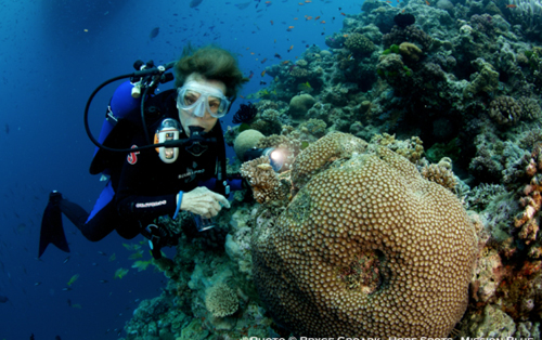 The Coral Sea off the northeast coast of Australia is named for its staggering number of corals. This area: includes the Great Barrier Reef and is one of the most diverse marine habitats on Earth. The Coral Sea is an epic spot – a massive space home to so much life. The Hope is to increase the protection from parts of the Great Barrier Reef to the outer Coral Sea area – and get spots like Holmes Reef back to where it should be. To learn more about potential new laws which will protect the Coral Sea and make it the world’s largest permanent marine park, go to: http://www.protectourcoralsea.org.au Text Bryce Groark – May, 2013 Photograph© Bryce Groark courtesy of Mission Blue
Coral Sea
“The Coral Sea is a marginal sea off the northeast coast of Australia. Named for its staggering number of corals, this area includes the Great Barrier Reef and is one of the most diverse marine habitats on Earth. Spectacular coral reefs, remote islands and towering underwater mountains along with deep-sea canyons add to the diversity and uniqueness of this area.”
The Eastern Pacific Seascape spans Central and South America, covering a total of 2 million square kilometers. A number of the world’s most important natural habitats lie within the Eastern Pacific Seascape, including Malpelo and Cocos Islands, Coiba, and the Galapagos, where Charles Darwin carried out his groundbreaking research. Each region within the Eastern Pacific Seascape has unique environmental, economic and cultural importance.
Mission Blue Cocos Expedition
Surrounded by deep waters and strong currents, Cocos Island has long been admired by scuba divers for its wealth of marine life. Large pelagic species are very abundant in the cool productive waters surrounding Cocos and divers often see large schools of hammerhead sharks, dolphin, tuna, and schools of snapper. Jacques Cousteau visited Cocos several times and raved about its incredible beauty. Cocos Island was declared a National Park by the Costa Rican government in 1978 and in 1997, UNESCO designated Cocos a world heritage site. In 2002, the surrounding waters were included under that protection. Despite its status as one of the most important marine conservation sites in the world, Cocos is still under pressure from illegal poaching of sharks, tuna, and other marine species. In 2011, expedition team members Kip Evans and Shari Sant Plummer joined conservation visionary and SEA board member Ann Luskey to assist in the tagging of endangered sea turtles around Cocos. Read the complete story here!
Video and Featured Photo: Kip Evans / Mission Blue
Mission Blue offers Hope Spot expeditions
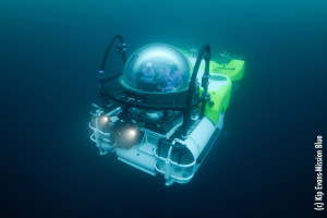 Mission Blue offers Hope Spot expeditions, short duration trips, typically 2 weeks or less,: that require only a small team to execute. “They are designed to create awareness, foster partnerships, and build public support for the creation of marine protected areas, or “Hope Spots” across the globe.” Photograph courtesy of Mission BlueExpedition Program Goals
· Highlight areas that need attention, or need to be saved before it’s too late
· Highlight areas that can serve as a beacon of hope
· Increase knowledge of current and potential Hope Spots
· Deliver a strong, strategic “Call to Action” that directly supports protection
· Collaborate with global partners to bring change
· Create multi-media materials for social media networks
· Strengthen the Mission Blue brand
· Raise funds for programs and partners
Discover ocean stories around the globe presented on Mission Blue at http://mission-blue.org/google-earth/.
Mission Blue's Many Partners include the The Global Partnership for Oceans and Protect Planet Ocean
“When people look at water, they see just water. But it not just water, it is a living system that shapes the character of the planet,” Sylvia Earle says in her opening remarks to the video, “Global Partnership for Oceans.”
The Global Partnership for Oceans is a growing alliance of governments, international organizations, civil society groups, and private sector interests committed to addressing the threats to the health, productivity and resilience of the world's oceans. Published on YouTube March 28, 2012.
The Global Partnership for Oceans (GPO) “is a growing alliance of more than 100 governments, international organizations, civil society groups, and private sector interests committed to addressing the threats to the health, productivity and resilience of the world’s oceans. It aims to tackle widely documented problems of overfishing, pollution, and habitat loss. Together these problems are contributing to the depletion of a natural resource bank that provides nutrition, livelihoods and vital ecosystem services.” The Sylvia Earle Alliance /Mission Blue is a Partner.
The GPO Fact Sheet (pdf).
The GPO plans to work on the following ocean-related issues:
- Marine-Protected Areas
- Rights-based Fisheries
- Wealth Accounting
- Governance
- Aquaculture
- Seafood Certification
- Pollution
On October 16th, 2013, Dr. Sylvia Earle and the Global Partnership for Oceans Blue Ribbon Panel released Indispensable Ocean a global strategy for aligning ocean health and human well-being. The 21 global experts from 16 countries who prepared the report, emphasize that without action to turn around the declining health of the ocean, the consequences for economies, communities and ecosystems will be irreversible.
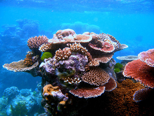 Coral Outcrop Flynn Reef: Photograph courtesy of Mission Blue
Protect Planet Ocean:
Protect Planet Ocean is an initiative by IUCN with the collaboration with UNEP-WCMC available at http://www.protectplanetocean.org/.
The answers to the following questions can be found at the “Learn more” links following each question.
Why are oceans important? Learn more
What are marine protected areas (MPAs)? Learn more
What impacts do humans have on the ocean? Learn more
What are Marine Reserves? Learn more
How can MPAs and reserves help? Learn more
What are networks of MPAs and reserves? Learn more
Global facts about MPAs and marine reserves Learn more
Targets to increase marine protection Learn more
IUCN WCPA-Marine Plan of Action Learn more
How do we decide where to place MPAs and reserves? Learn more
What are Marine World Heritage Sites? Learn more
Glossary
Marine Conservation terms Learn more
National Oceanic and Atmospheric Administration (NOAA):
National Ocean Service (NOS) Marine Protected Areas
Available at http://oceanservice.noaa.gov/ecosystems/mpa/#1
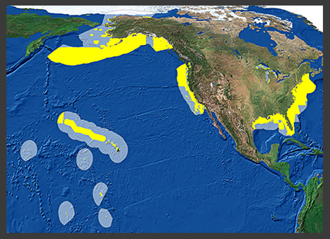 U.S. Marine Protected Areas
What is a Marine Protected Area?
Did you know that 41 percent of U.S. marine waters are protected in some way? If you have ever gone fishing in central California, diving in the Florida Keys, or boating in Thunder Bay, you have visited one of these marine protected areas (MPA).
MPAs are areas of the oceans or Great Lakes that are protected for a conservation purpose. In the United States, there are over 1,600 MPAs spanning a range of habitats, including the open ocean, coastal areas, inter-tidal zones, estuaries, and the Great Lakes. Nearly all of these areas allow multiple uses. About one percent of U.S. waters are highly protected in no-take MPAs to protect sensitive species and habitats.
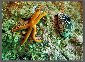 Interested in finding out if there are marine protected areas (MPAs) where you live or have visited?: Check out the Marine Protected Areas Inventory.MPA Inventory
Interested in finding out if there are marine protected areas (MPAs) where you live or have visited? Check out the Marine Protected Areas Inventory. This online tool lets you use an interactive map to view the MPA Inventory sites and associated data, query sites by specific conservation attributes, or to search and view sites by region. Managers can use the Inventory for marine management and conservation planning. In fact, the primary purpose of the Inventory is to maintain baseline information on MPAs to the assist in the development of the National System of MPAs.
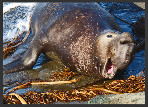 Managed by the federal government, the national system of MPAs brings work together at the regional: and national levels to achieve common objectives for conserving the nation's important natural and cultural resources.National System of MPAs
With different federal, state, tribal and local agencies managing the more than 1,600 marine protected areas (MPAs) located all over the U.S., what is going on in each can get a little disjointed and opportunities to coordinate or share lessons learned can be missed. So wouldn't it be nice if there were some system to coordinate planning and management of our nation's MPAs? Guess what? There is!
Managed by the federal government, the national system of MPAs brings work together at the regional and national levels to achieve common objectives for conserving the nation's important natural and cultural resources. The MPAs in the system are still managed independently, but they now have a framework to tie them all together. There are currently 437 members of the national system of MPAs. Over time, the MPA Center will continue to work with existing U.S. MPAs to increase membership in the national system.
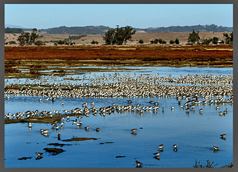 Classifying MPAs
Classifying MPAs
MPA Classification system can be found here at http://marineprotectedareas.noaa.gov/aboutmpas/classification/
Because marine protected areas (MPAs) vary widely, the National MPA Center developed a system to help describe these areas using characteristics that are common to most MPAs. The characteristics include conservation focus, level of protection, permanence of protection, constancy of protection, and ecological scale of protection. The end result is a common vocabulary for MPA managers, something that comes in handy when exchanging ideas and lessons learned or working to identify additional areas that should be protected.
Science and Stewardship
The MPA Center uses science to assess the nature of MPAs and how they are used to sustain healthy marine ecosystems. The MPA Center focuses its objectives on enhancing MPA stewardship by strengthening capacity for planning, management, and evaluation.
The California Ocean Uses Atlas Project is one example of a science and stewardship focused project of the MPA Center. The Atlas fills a critical information gap in ocean management by mapping the full range of significant human uses of the ocean in state and federal waters. Data and maps from the California Ocean Uses Atlas workshops are available online.
Case Studies:
There are many different types of MPAs including national marine sanctuaries and national estuarine research reserves.
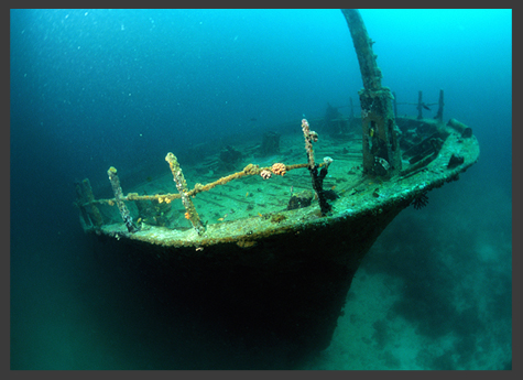
Another example of a marine protected area is South Slough National Estuarine Research Reserve. Since the creation of the reserve, management plans have sought to restrict the most intensive commercial uses and restore natural processes, while ensuring that South Slough is available for public recreational use.
The 13 national marine sanctuaries, managed directly by NOS, and the 27 national estuarine research reserves, managed by states in partnership with NOS, are part of the National MPA Center inventory. Additionally, all 13 national marine sanctuaries and five national estuarine research reserves are members of the national system of MPAs.
Visit the slideshow of South Slough National Estuarine Research Reserve.
Florida Keys National Marine Sanctuary
Few marine environments in the United States compare to the Florida Keys in natural beauty and resource diversity. An island chain on the southern tip of the Florida peninsula, the Keys are surrounded by the Atlantic Ocean to the south, and Florida Bay and the Gulf of Mexico to the north. They stretch 202 miles (356 km) to the south and west, ending 90 miles north of Cuba. On the ocean side, adjacent to the island chain, lies North America's only living coral barrier reef. This reef system is the most extensive living coral reef in the U.S. and is the third largest barrier reef in the world (FKNMS, 2001). It is part of a productive marine ecosystem that includes patch and bank reefs, seagrass meadows, soft and hard bottom communities, and coastal mangroves. This matrix of interconnected habitats supports one of the most biologically diverse assemblages of marine life in North America (DOC, 1996).
A Closer Look at Marine Protected Areas
Stories of Special Places
Our marine protected areas have stories to tell about our nation's past – and future. Check out these stories of the natural world, and of history, exploration, shipwrecks, and conflict.
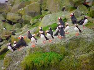
The sheer span on Alaska Maritime National Wildlife Refuge is difficult to grasp. It ranges across most of the 47,300 miles of Alaska's coastline and includes 2,500 islands, islets, spires, rocks, reefs, waters and headlands. ...continue reading
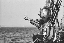
Cabrillo National Monument is named after Juan Rodriguez Cabrillo, who led the first European expedition to explore what is now the West coast of the United States. Cabrillo departed in his flagship, the San Salvador, from the port of Navidad, Mexico on June 27, 1542 and three months later arrived at what is known today as San Diego Bay. ...continue reading
The Dry Tortugas – about 70 miles west of Key West -- were discovered by Ponce de Leon in 1513. The route was frequently used by Spanish ships returning home from Mexico, the Caribbean or the Gulf Coast of Florida. ...continue reading
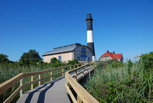
For decades, the first evidence of land for travelers crossing the vast Atlantic Ocean from Europe was the Fire Island Lighthouse. Completed in 1858 near the site of its 1826 predecessor, the current Fire Island Light is still a beacon attracting thousands of people each year. ...continue reading
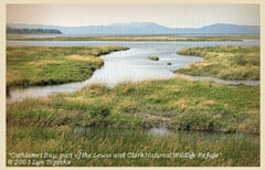
The islands and estuary of the Lewis and Clark National Wildlife Refuge have always been a meeting place of waters and people. The Chinook and Cathlamet Indians were famed traders encountered by early European explorers and traders. ...continue reading
By the end of the 19th century, the increased demand for bird feathers in the fashion industry resulted in the mass slaughter of herons, egrets, spoonbills and pelicans. At one point, plume feathers were worth more than gold! ...continue reading
On November 14, 1493, on his second voyage to the New World, Columbus came upon the island which the dominant Carib people called Cibuquiera ("the stony land"). He named it Santa Cruz or "Holy Cross". ...continue reading
In the San Juan Islands in Washington, the US and Canada nearly went to war over a pig. But let's start at the beginning. Long before the arrival of Europeans, the San Juan Island was home to the Coast Salish tribes, attracted by its temperate climate, rich soil, abundant timber and marine resources. ...continue reading
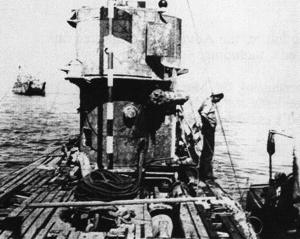 The U-1105 Black Panther: Photograph courtesy of NOAA
U-1105 Black Panther Historic Shipwreck Preserve
The U-1105 submarine began its wartime career when it was launched by Germany on April 20, 1944. It was an experimental design – less than ten were commissioned during the war -- that was outfitted with a synthetic rubber skin to counter Allied sonar devices, earning it the nickname "Black Panther." ...continue reading
The Virgin Islands Coral Reef National Monument encompasses over half the island of St. John and almost all of Hassel Island preserving stories of the prehistoric past and over a hundred historic sites that together complete one the most undisturbed and comprehensive Caribbean landscapes. ...continue reading
National Geographic Ocean Views Blog
A National Geographic blog, Bold Plan for 50 Ocean Hope Spots Announced at IMPAC 3 with about the new Hope Spots was posted by Brett Garling in Ocean Views on October 22, 2013 and you can click here for the global map.
“Ocean Views brings new and experienced voices together to discuss the threats facing our ocean and to celebrate successes. We strive to raise awareness worldwide to the benefits of restoring fisheries and creating marine reserves. “This blog is hosted by Dr. Enric Sala, Explorer-in-Residence with National Geographic. For tips or inquiries email bhoward at ngs.org.”
America's Cup Healthy Ocean Project
The 34th America’s Cup Healthy Ocean Project is a Global “Call to Action” Campaign that embraces the connection between sailing and the ocean.
“Our overall goal of the Healthy Ocean Project is to create awareness around the problems that face the ocean and inspire individual action around the solutions that exist. We focus our efforts on three core issues – Marine Protected Areas, Sustainable Seafood and Marine Debris/Plastics.”
With Dr. Sylvia Earle serving as global ambassador for the America's Cup Healthy Ocean Project, Mission Blue worked with ACHOP partners to create awareness about marine debris, promote sustainable seafood, and educate the public about marine protected areas. Hosted by the Aquarium of the Bay in San Francisco, the two-year long Film and Lecture series was described to have been “a huge hit.” In August, Dr. Earle hosted a panel, “Women in Science.”
The Project also held a Pledge Campaign to support California Marine Protected Areas and the expansion of the National Marine Sanctuary off San Francisco.
Book: Ocean: An Illustrated Atlas
Ocean: An Illustrated Atlas by Dr. Sylvia Earle and Linda Glover Released by National Geographic, in 2009, presents a review of the book. “National Geographic offers state of the art maps of the ocean’s sea floors including the areas of the newly designated National Marine Monuments,” says the article available on the Horizon International Solutions Site at http://www.solutions-site.org/node/343.
Dr. Sylvia Earle writes in The Last Word of the book: “There is time, but not a lot, to use that wondrous capacity that humans have to dream, to anticipate the next decade, century, millennium, and beyond. If we so choose, we have the power to craft a world where we respect and live in peace with ourselves and with the mostly blue world that sustains us.”
The book is available from the Mission Blue shop at http://mission-blue.org/shop/
About the Sylvia Earle Alliance
The Sylvia Earle Alliance’s (SEA) purpose is to explore and care for the ocean. We are committed to inspiring a sea change in public awareness, access and support for marine protected areas worldwide, ranging from the deepest ocean to sunlit reefs, and from the seamounts of the high seas to coastal seagrass meadows.
“We draw inspiration from the vision evoked by our founder, Dr. Sylvia Earle: to ignite public support for a global network of marine protected areas – Hope Spots large enough to save and restore the ocean, the blue heart of the planet.
“Under Dr. Earle’s leadership, the SEA team has embarked on a series of expeditions to further this vision and shed light on these ocean Hope Spots. We also bring the discoveries and stories of a network of ocean experts to the public through documentaries, social and traditional media, and innovative tools like Google Earth’s “Explore the Ocean” layer. Additionally, we support the work of many conservation NGO’s with whom we share the basic mission of ocean protection and public awareness.”
About Dr. Sylvia A. Earle
National Geographic’s description: “National Geographic Society Explorer-in-Residence Dr. Sylvia A. Earle, called "Her Deepness" by the New Yorker and the New York Times, "Living Legend" by the Library of Congress, and first "Hero for the Planet" by Time magazine, is an oceanographer, explorer, author, and lecturer. She has experience as a field research scientist, government official, and director for corporate and nonprofit organizations, including the Kerr McGee Corporation, Dresser Industries, Oryx Energy, the Aspen Institute, the Conservation Fund, American Rivers, Mote Marine Laboratory, Duke University Marine Laboratory, Rutgers Institute for Marine Science, the Woods Hole Oceanographic Institution, National Marine Sanctuary Foundation, and Ocean Futures.”
Dr. Earle and Carl Gustaf Lundin are Horizon International Special Advisors.
Search
Latest articles
Agriculture
- World Water Week: Healthy ecosystems essential to human health: from coronavirus to malnutrition Online session Wednesday 24 August 17:00-18:20
- World Water Week: Healthy ecosystems essential to human health: from coronavirus to malnutrition Online session Wednesday 24 August 17:00-18:20
Air Pollution
- "Water and Sanitation-Related Diseases and the Changing Environment: Challenges, Interventions, and Preventive Measures" Volume 2 Is Now Available
- Global Innovation Exchange Co-Created by Horizon International, USAID, Bill and Melinda Gates Foundation and Others
Biodiversity
- It is time for international mobilization against climate change
- World Water Week: Healthy ecosystems essential to human health: from coronavirus to malnutrition Online session Wednesday 24 August 17:00-18:20
Desertification
- World Water Week: Healthy ecosystems essential to human health: from coronavirus to malnutrition Online session Wednesday 24 August 17:00-18:20
- UN Food Systems Summit Receives Over 1,200 Ideas to Help Meet Sustainable Development Goals
Endangered Species
- Mangrove Action Project Collaborates to Restore and Preserve Mangrove Ecosystems
- Coral Research in Palau offers a “Glimmer of Hope”
Energy
- Global Innovation Exchange Co-Created by Horizon International, USAID, Bill and Melinda Gates Foundation and Others
- Wildlife Preservation in Southeast Nova Scotia
Exhibits
- Global Innovation Exchange Co-Created by Horizon International, USAID, Bill and Melinda Gates Foundation and Others
- Coral Reefs
Forests
- NASA Satellites Reveal Major Shifts in Global Freshwater Updated June 2020
- Global Innovation Exchange Co-Created by Horizon International, USAID, Bill and Melinda Gates Foundation and Others
Global Climate Change
- It is time for international mobilization against climate change
- It is time for international mobilization against climate change
Global Health
- World Water Week: Healthy ecosystems essential to human health: from coronavirus to malnutrition Online session Wednesday 24 August 17:00-18:20
- More than 400 schoolgirls, family and teachers rescued from Afghanistan by small coalition
Industry
- "Water and Sanitation-Related Diseases and the Changing Environment: Challenges, Interventions, and Preventive Measures" Volume 2 Is Now Available
- Global Innovation Exchange Co-Created by Horizon International, USAID, Bill and Melinda Gates Foundation and Others
Natural Disaster Relief
- STOP ATTACKS ON HEALTH CARE IN UKRAINE
- Global Innovation Exchange Co-Created by Horizon International, USAID, Bill and Melinda Gates Foundation and Others
News and Special Reports
- World Water Week: Healthy ecosystems essential to human health: from coronavirus to malnutrition Online session Wednesday 24 August 17:00-18:20
- STOP ATTACKS ON HEALTH CARE IN UKRAINE
Oceans, Coral Reefs
- World Water Week: Healthy ecosystems essential to human health: from coronavirus to malnutrition Online session Wednesday 24 August 17:00-18:20
- Mangrove Action Project Collaborates to Restore and Preserve Mangrove Ecosystems
Pollution
- Zakaria Ouedraogo of Burkina Faso Produces Film “Nzoue Fiyen: Water Not Drinkable”
- "Water and Sanitation-Related Diseases and the Changing Environment: Challenges, Interventions, and Preventive Measures" Volume 2 Is Now Available
Population
- "Water and Sanitation-Related Diseases and the Changing Environment: Challenges, Interventions, and Preventive Measures" Volume 2 Is Now Available
- "Water and Sanitation-Related Diseases and the Changing Environment: Challenges, Interventions, and Preventive Measures" Volume 2 Is Now Available
Public Health
- Honouring the visionary behind India’s sanitation revolution
- Honouring the visionary behind India’s sanitation revolution
Rivers
- World Water Week: Healthy ecosystems essential to human health: from coronavirus to malnutrition Online session Wednesday 24 August 17:00-18:20
- Mangrove Action Project Collaborates to Restore and Preserve Mangrove Ecosystems
Sanitation
- Honouring the visionary behind India’s sanitation revolution
- Honouring the visionary behind India’s sanitation revolution
Toxic Chemicals
- "Water and Sanitation-Related Diseases and the Changing Environment: Challenges, Interventions, and Preventive Measures" Volume 2 Is Now Available
- Actions to Prevent Polluted Drinking Water in the United States
Transportation
- "Water and Sanitation-Related Diseases and the Changing Environment: Challenges, Interventions, and Preventive Measures" Volume 2 Is Now Available
- Urbanization Provides Opportunities for Transition to a Green Economy, Says New Report
Waste Management
- Honouring the visionary behind India’s sanitation revolution
- Honouring the visionary behind India’s sanitation revolution
Water
- Honouring the visionary behind India’s sanitation revolution
- Honouring the visionary behind India’s sanitation revolution
Water and Sanitation
- Honouring the visionary behind India’s sanitation revolution
- Honouring the visionary behind India’s sanitation revolution

