Navigation
Fishing Ban Protects Largest Coral Reef in The Philippines, Apo Reef
Reef fish and other marine species can breathe easier with the introduction of a fishing ban around Apo Reef, the largest coral reef in the Philippines and the second largest contiguous reef in the world after the Great Barrier Reef.
 |
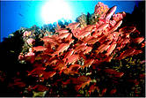
| Swarms of pastel-hued wreckfish, one of more than 385 fish species found within the Apo Reef Natural Park, the Philippines. © Scott Tuason / WWF-Philippines |
Reef fish and other marine species can breathe easier with the introduction of a fishing ban around Apo Reef, the largest coral reef in the Philippines and the second largest contiguous reef in the world after the Great Barrier Reef.
Under the ban, all extractive activities, such as fishing, and coral collection and harvesting, will be completely forbidden.
“This ‘no-take’ zone will allow the reef and its residents ample time to recover from years of fishing,” stressed John Manul of WWF-Philippines.
The 27,469-hectare Apo Reef off the coast of Mindoro Island is surrounded by mangrove forest, which serves as a source of food, nursery and spawning ground of several coastal fish and marine species, including sharks, manta rays, sperm whales and several sea turtles.
In 1996, the reef was declared a national park, but enforcement proved lax and illegal fishing methods persisted.
 |
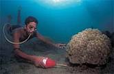
| Cyanide fishing in coral reef, the Philippines. © WWF-Canon / Jürgen Freund |
The park was once one of the world’s premier diving destinations, but years of fishing — including by unsustainable fishing practices such as using dynamite and cyanide — took its toll.
“You would hear 25 to 30 dynamite blasts daily,” said Robert Duquil, a former protected area assistant superintendent. “The international diving community lost interest in the area and destructive activities prevailed.”
Adding to the reef’s troubles, the El Niño phenomenon in 1998 raised ocean temperatures, prompting a massive bleaching episode and the death of countless corals, and an explosion of coral-eating crown-of-thorns starfish.
“Unfortunately, Apo is plagued by millions of these starfish, probably due to a lack of natural predators like the giant triton, napoleon wrasse and harlequin shrimp,” said Gregg Yan of WWF-Philippines. “We hope that the ban will ensure protection of these predators and the many other reef species.”
WWF has been working towards sustainable coastal practices for the Apo Reef Natural Park since 2003. The marine park will be opened for tourists to help generate funds for its protection, as well as provide an alternative livelihood for hundreds of fishermen in the area.
For more information:
John Manul, Sablayan Project Manager
WWF-Philippines
jmanul@wwf.org.ph
Gregg Yan, Communications Officer
WWF-Philippines
gyan@wwf.org.ph
The World Wildlife Fund is solely responsible for the contents of this article of Oct 5, 2007 from Manila, the Philippines.
NOTE:
UNESCO description of Apo Reef from its World Heritage Tentative Lists Database:
Submission prepared by:
Department of Environment and Natural Resources (DENR) - Protected Areas and Wildlife Bureau
State, Province or Region:
Sablayan, Occidental Mindoro
Coordinates:
N12 44 47 E120 23 46
Ref.: 5033
Description
Apo Reef is the second largest contiguous coral reef in the world and the largest one in the Philippines. The Apo Reef Natural Park consists of the three islands. Apo Reef is the largest among the three islands. It has a shallow lagoon with a depth of 2 meters to 10 meters surrounded by mangrove forest which serves as source of food, nursery and spawning ground of several coastal and marine species of fauna and sanctuary of birds. Its diverse corals are approximately 34 sq. km. of reef where different species of fish, marine mammals and invertebrates thrive.
Apo Reef, the largest atoll like reef in the Philippines, is a submerged platform that is a submerged of a 34 sqkm sub triangular northern m and southern atoll like reefs separated by a 30-m deep channel that is open to the west The channel runs east to west from 1.8 m to 30 m deep with a fine white sand bottom numerous mounds and patches of branching corals under the deep blue water.
The main geographical features of Apo Reef is submerged. There are three islands that mark it on the surface, the Apo Island, Apo Menor (Binangaan'; and Cayos del Bajo Tinangkapang). The largest is Apo Island (22.0) hectares which harbors mangroves and beach vegetations, whereas Binangaan is rocky Iimestone island with relatively few vegetation and Cayos del Bajo (200-300 sq.m.) is a coralline rock formation with no vegetation.
Justification for Outstanding Universal Value
Statements of authenticity and/or integrity:
Apo Reef was proclaimed as Protected Area under the category of Natural Park and it Surrounding waters as buffer zone by virtue of Presidential Proclamation No. 868, dated September 6, 1996. The Apo Reef Natural Park (ARNP) and its peripheral Buffer Zone covers an area of 15,792 hectares and 11,677 hectares, respectively, totaling 27,469 hectares in all.
Prior to its declaration as a Protected Area under the category of Natural Park, Apo Reef has been designated as Marine Park through Presidential Proclamation No. 1801 in 1980, authorizing the Philippine Tourism Authority PTA to undertake the development and Management of the area. It was also declared a tourist Zone and Marine Reserve by virtue of Sablayan, Occidental Mindoro Sangguaniang Bayan Resolution No. 1108 in 1983. In the quest for a more comprehensive program in protected area management the concept of an Integrated Protected Areas System (IPAS) was developed in 1989 by the Haribon Foundation, a non-governmental organization (NCO), through a grant by the Worldwide Fund for Nature (WWF)-US. By 1990, IPAS Phase I, an 18-month study was undertaken. Its major achievements included the enactment of Republic Act 7586 establishing the National Integrated Protected Areas System (NIPAS) in 1992 and its implementing rules and regulations, and the tentative listing of IP sites all over the country and the identification of ten (10) priority sites including the IPAS Reef Natural Park.
The second phase of IPAS is generally known as the implementation stage. The Conservation of Priority Protected Areas Project (CPPAP), which is being funded by the Global Environmental Facility (CEF) forms part of this phase. Implementation of this project in a ten 10 - pilot sites identified during IPAS Phase I, is currently being jointly undertaken by the Government of the Philippines (COP), through the Department of Environment and Natural Resources DENR and a consortium of local and national development and environment- oriented NGO's, the NGO's for Integrated Protected Areas (NIPA), Inc.
Grounded on the framework set by the NIPAS Act, active participation of local communities and other non-traditional PA Management actors is a crucial element in the project's implementation. The vehicle for this is the DENR, LGU's and the civil society e.g. PO:, ICCs, and NGOs). The CPPAP is an an attempt to contextualize the new strategy of protected area management which addresses the various social, cultural, political and economic values that influence protected area management of the
Comparison with other similar properties:
Apo Reef Natural Park compared to that of Tubbataha National Marine Park has a unique natural phenomena. Apo Reef has a high diversity of corals and has an island covered with terrestrial vegetation. Apo Reef, the largest atoll like reef in the Philippines, is a submerged platform that is a submerged of a 34 sqkm sub triangular northern m and southern atoll like reefs separated by a 30-m deep channel that is open to the west
Search
Latest articles
Agriculture
- World Water Week: Healthy ecosystems essential to human health: from coronavirus to malnutrition Online session Wednesday 24 August 17:00-18:20
- World Water Week: Healthy ecosystems essential to human health: from coronavirus to malnutrition Online session Wednesday 24 August 17:00-18:20
Air Pollution
- "Water and Sanitation-Related Diseases and the Changing Environment: Challenges, Interventions, and Preventive Measures" Volume 2 Is Now Available
- Global Innovation Exchange Co-Created by Horizon International, USAID, Bill and Melinda Gates Foundation and Others
Biodiversity
- World Water Week: Healthy ecosystems essential to human health: from coronavirus to malnutrition Online session Wednesday 24 August 17:00-18:20
- Mangrove Action Project Collaborates to Restore and Preserve Mangrove Ecosystems
Desertification
- World Water Week: Healthy ecosystems essential to human health: from coronavirus to malnutrition Online session Wednesday 24 August 17:00-18:20
- UN Food Systems Summit Receives Over 1,200 Ideas to Help Meet Sustainable Development Goals
Endangered Species
- Mangrove Action Project Collaborates to Restore and Preserve Mangrove Ecosystems
- Coral Research in Palau offers a “Glimmer of Hope”
Energy
- Global Innovation Exchange Co-Created by Horizon International, USAID, Bill and Melinda Gates Foundation and Others
- Wildlife Preservation in Southeast Nova Scotia
Exhibits
- Global Innovation Exchange Co-Created by Horizon International, USAID, Bill and Melinda Gates Foundation and Others
- Coral Reefs
Forests
- NASA Satellites Reveal Major Shifts in Global Freshwater Updated June 2020
- Global Innovation Exchange Co-Created by Horizon International, USAID, Bill and Melinda Gates Foundation and Others
Global Climate Change
- World Water Week: Healthy ecosystems essential to human health: from coronavirus to malnutrition Online session Wednesday 24 August 17:00-18:20
- Mangrove Action Project Collaborates to Restore and Preserve Mangrove Ecosystems
Global Health
- World Water Week: Healthy ecosystems essential to human health: from coronavirus to malnutrition Online session Wednesday 24 August 17:00-18:20
- More than 400 schoolgirls, family and teachers rescued from Afghanistan by small coalition
Industry
- "Water and Sanitation-Related Diseases and the Changing Environment: Challenges, Interventions, and Preventive Measures" Volume 2 Is Now Available
- Global Innovation Exchange Co-Created by Horizon International, USAID, Bill and Melinda Gates Foundation and Others
Natural Disaster Relief
- STOP ATTACKS ON HEALTH CARE IN UKRAINE
- Global Innovation Exchange Co-Created by Horizon International, USAID, Bill and Melinda Gates Foundation and Others
News and Special Reports
- World Water Week: Healthy ecosystems essential to human health: from coronavirus to malnutrition Online session Wednesday 24 August 17:00-18:20
- STOP ATTACKS ON HEALTH CARE IN UKRAINE
Oceans, Coral Reefs
- World Water Week: Healthy ecosystems essential to human health: from coronavirus to malnutrition Online session Wednesday 24 August 17:00-18:20
- Mangrove Action Project Collaborates to Restore and Preserve Mangrove Ecosystems
Pollution
- Zakaria Ouedraogo of Burkina Faso Produces Film “Nzoue Fiyen: Water Not Drinkable”
- "Water and Sanitation-Related Diseases and the Changing Environment: Challenges, Interventions, and Preventive Measures" Volume 2 Is Now Available
Population
- "Water and Sanitation-Related Diseases and the Changing Environment: Challenges, Interventions, and Preventive Measures" Volume 2 Is Now Available
- "Water and Sanitation-Related Diseases and the Changing Environment: Challenges, Interventions, and Preventive Measures" Volume 2 Is Now Available
Public Health
- Honouring the visionary behind India’s sanitation revolution
- Honouring the visionary behind India’s sanitation revolution
Rivers
- World Water Week: Healthy ecosystems essential to human health: from coronavirus to malnutrition Online session Wednesday 24 August 17:00-18:20
- Mangrove Action Project Collaborates to Restore and Preserve Mangrove Ecosystems
Sanitation
- Honouring the visionary behind India’s sanitation revolution
- Honouring the visionary behind India’s sanitation revolution
Toxic Chemicals
- "Water and Sanitation-Related Diseases and the Changing Environment: Challenges, Interventions, and Preventive Measures" Volume 2 Is Now Available
- Actions to Prevent Polluted Drinking Water in the United States
Transportation
- "Water and Sanitation-Related Diseases and the Changing Environment: Challenges, Interventions, and Preventive Measures" Volume 2 Is Now Available
- Urbanization Provides Opportunities for Transition to a Green Economy, Says New Report
Waste Management
- Honouring the visionary behind India’s sanitation revolution
- Honouring the visionary behind India’s sanitation revolution
Water
- Honouring the visionary behind India’s sanitation revolution
- Honouring the visionary behind India’s sanitation revolution
Water and Sanitation
- Honouring the visionary behind India’s sanitation revolution
- Honouring the visionary behind India’s sanitation revolution

