HORIZON INTERNATIONAL SOLUTIONS SITE
Working to Find and advance solutions to environment, health, poverty, and development problems
A new map published by the European Commission shows the photovoltaic solar energy potential of different parts of Europe. Photovoltaic Solar Cells convert sunlight directly into electricity.
A new map published by the European Commission shows the photovoltaic solar energy potential of different parts of Europe. Photovoltaic Solar Cells convert sunlight directly into electricity.
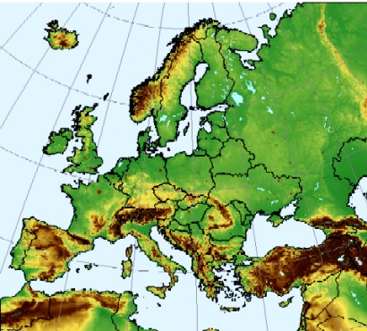 |
| Photovoltaic Geographical Information System (PVGIS) Photovoltaic (PV) Estimation Utility Map: European Commission Joint Research Center |
In addition the interactive on-line Photovoltaic Geographical Information System (PVGIS), developed by the Commission's in-house scientific service, DG Joint Research Centre, allows users to estimate solar energy performance at any given location in Europe.
The information in the map shows that an identical solar system will generate twice as much energy in sunny areas of Europe, such as Malta and Southern Spain, than in areas such as Scotland or Northern Scandinavia. These tools are invaluable as the EU seeks to increase the share of renewable energies in its consumption to 20% in 2020.
While it is perhaps no surprise that the solar energy potential of Southern Europe is higher than Northern Europe, the interactive information service map allows very specific calculation of the amount of energy that can be generated in any given location in Europe and its neighbouring regions. This calculation is based on knowledge of the sun's energy, geographic distribution, the different terrain across Europe and detailed technological analysis of the available photovoltaic technologies.
It also shows that considerable potential exists in Europe for greater use of solar energy.
In addition to the map and the interactive service, the Photovoltaic Geographical Information System provides a wealth of information about the development of photovoltaic technology, such as figures on its share of total national electricity consumption in each Member State, up-to-date research on photovoltaics and links to world-wide databases of solar technology and data.
The new Photovoltaic Geographical Information System is a powerful tool for the development of new solar power plants, such as the PS10 Concentrating Solar Power palnt in Seville, Southern Spain.
Research is an important element in efforts to increase renewable energy generation. The European Commission has supported the creation of a European Photovoltaic Technology Platform, which mobilises industry, academia, regulators, financial institutions, and all others with an interest in developing European leadership in photovoltaics. The Technology Platform has designed a Strategic Research Agenda in which the main research and technological development issues for the sector over the next decade are addressed. These include the various technologies for harnessing solar energy, efficiency, storage and distribution to the grid.
Interactive services of PVGIS can be found at: http://re.jrc.ec.europa.eu/solarec.
The solar map can be downloaded from http://re.jrc.ec.europa.eu/pvgis/.
Photovoltaic Geographical Information System (PVGIS) Geographical Assessment of Solar Resource and Performance of Photovoltaic Technology
http://re.jrc.ec.europa.eu/pvgis/apps3/pvest.php
The Renewable Energies Unit of the Joint Research Centre of the European Commission new version of the PVGIS Web applications for estimating solar radiation and solar energy performance in Europe features:
The most important feature of the new version is an increase in the spatial resolution of terrain data. Where the previous version was based on digital elevation model with a spatial resolution of 1 km, the new version incorporates data with a 100 m resolution.
This leads to significantly improved estimates of solar radiation in mountainous areas, both because of a better knowledge of the altitude at a given location and because of an improved calculation of the effects of shadows by nearby mountains or hills.
Explore the interactive maps. http://re.jrc.ec.europa.eu/pvgis/apps/pvest.php?lang=en&map=europe
Notes:
What is GIS?
A Geographical Information System (GIS) is a combination of computer hardware and software that is designed to manage, process, analyze and visualize georeferenced (map) data.
What is PVGIS?
PVGIS (Photovoltaic Geographical Information System) is a research, demonstration and policy-support instrument for geographical assessment of the solar energy resource in the context of integrated management of distributed energy generation. PVGIS combines our team expertise from laboratory research, monitoring and testing with geographical knowledge to analyse technical, environmental and socio-economic factors of solar electricity generation. PVGIS is a part of the SOLAREC action at the JRC Renewable Energies Unit.